Winter weather likely missing Shelby County
Published 8:00 pm Sunday, February 15, 2015
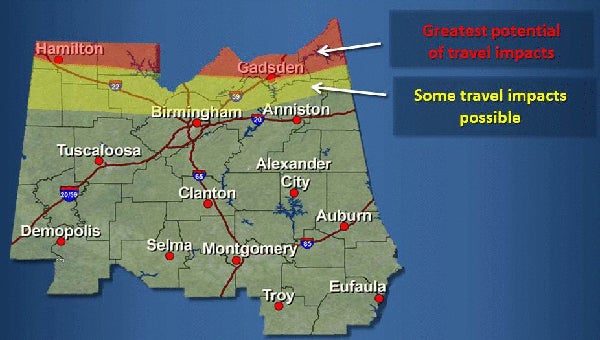
The majority of the winter weather threat will pass north of Shelby County over the next few days. (Contributed)
By NEAL WAGNER / Managing Editor
The National Weather Service is warning of the potential for freezing rain over the next few days, but the majority of the winter weather threat will remain north of Shelby County.
The NWS originally predicted frigid temperatures and possible widespread winter weather throughout central Alabama beginning on Feb. 15, but the freezing rain threat likely will only impact areas north of Interstate 20.
Shelby County will see showers and a high of about 52 and a low of 28 on Feb. 16, followed by clear skies and a high of 40 and a low of 26 on Feb. 17. Feb. 18 will bring windy conditions with a high of 38 and a low of 15, followed by more clear skies and a high of 33 and a low of 22 on Feb. 19.
For the latest winter weather information, visit Srh.noaa.gov/bmx.
More News


-
-

-
Polls
 Loading ...


