Another wave of severe weather possible Thursday
Published 2:37 pm Wednesday, March 24, 2021
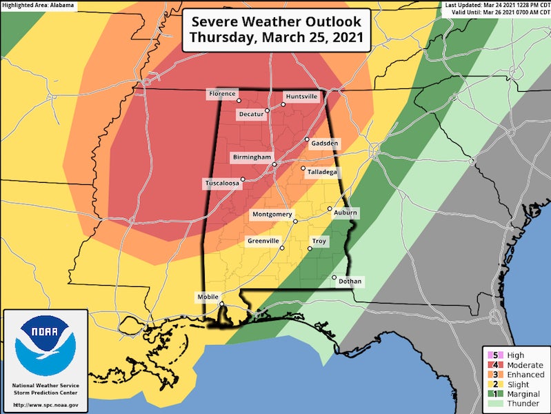
- Another dangerous wave of weather is headed toward Alabama and Shelby County on Thursday, March 24, bringing the threat for strong tornadoes, damaging winds and hail. (Graphic by Scott Martin, info from the National Weather Service)
|
Getting your Trinity Audio player ready...
|
By ALEC ETHEREDGE | Managing Editor
A week after many of us were spared the worst of a severe weather outbreak, another storm system is bringing the threat of severe weather once again on Thursday, March 24.
While the county was included in the high risk level last week, this Thursday’s severe weather threat is similar with much of the county being included in the moderate risk category.
Local meteorologists and meteorologists with the national weather service out of Birmingham are urging the same precaution this week.
Last week’s threat started as an enhanced risk before being upgraded to a moderate risk and then a high risk within a 24-hour span.
The county is currently split in half with the northern portion under the higher moderate risk (four out of five) and the southern part of the county under an enhanced risk (three out of five).
The threat from both includes tornadoes, damaging wind and hail. The moderate risk category has the possibility for more violent tornadoes, higher wind speeds of up to 70 miles per hour and golf ball size hail.
In the moderate risk, there is also a 15 percent chance there will be a tornado within 25 miles of your location, while the enhanced risk includes a 10 percent chance of a tornado within 25 miles.
The NOAA Storm Prediction Center has also said upgrading to the high risk category could happen due to the favorable environment for numerous supercells, which could produce violent, long-track tornadoes.
The current timeframe from the NWS shows severe storms possible between noon and 10 p.m. in Shelby County.
More 280 Main Story


-
-

-
Polls
 Loading ...


