Severe weather possible today and tonight
Published 9:28 am Friday, April 9, 2021
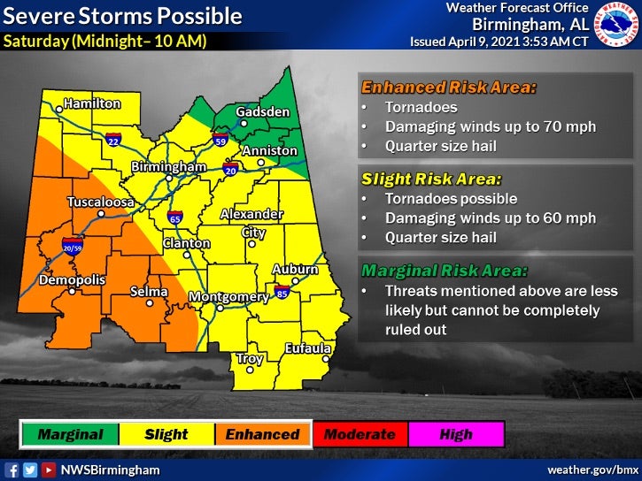
- Severe storms will move into Alabama Friday and Saturday with a possibility of producing damaging straight-line winds, hail and tornadoes. (Contributed)
|
Getting your Trinity Audio player ready...
|
By NATHAN HOWELL | Staff Writer
The National Weather Service is advising that there is a potential threat of severe weather for a large portion of the state between 10 a.m. Friday, April 9 and 10 a.m. the morning of Saturday, April 10.
For April 9, most of the state is in the slight risk level which includes the possibility of half dollar sized hail as well as damaging winds up to 60 mph.
Moving past midnight into Saturday, Shelby County is in the slight risk area with the possibility of tornadoes, damaging winds up to 60 mph and quarter sized hail.
As of Friday morning, strong storms were already affecting portions of the state including Marengo and Montgomery counties. The NWS advised that these storms could bring half inch hail and winds up to 40 mph.
Overnight there is an increased risk that the storms will bring damaging straight-line winds, which can cause significant damage and create dangerous situations for anyone exposed to them. During this time, there is also the opportunity for tornadoes to develop.
While the most severe threat is expected to be overnight, residents are advised to monitor local weather reports as the situation evolves.
More Alabaster Reporter


-
-

-
Polls
 Loading ...


